
Written by Scott Dallimore and Stephen Wolfe
As described in previous blog entries, the Araon science program began immediately upon crossing the Canadian border with bathymetric mapping using a hull-mounted multibeam sonar system and imaging of the subsurface geology with a sub-bottom sonar. After about 36 hours of transiting and science, the ship put in at Herschel Island to pick up three marine mammal observers to play a vital role while the ship conducts a multichannel seismic program. Scott Dallimore and Stephen Wolfe from the GSC are coordinating the logistics for the Herschel Island rendezvous with access to the site provided by Gwich’in Helicopters through the Polar Continental Shelf Project.
The flight from Inuvik to Herschel takes about 1.5 hours, crossing the Mackenzie Delta (the second largest delta in the Arctic) and then transiting along the north slope of Yukon. The scenery is indeed spectacular, as is the history of the area. Recognizing the unique character of Herschel Island, the Yukon Government established it as a Herschel Island-Qikiqtaruk Territorial Park in 1987 in accordance with the terms of the Inuvialuit Final Agreement.
The Yukon Government’s excellent web site http://www.env.gov.yk.ca/camping-parks/HerschelIslandQikiqtaruk.php explains that Herschel Island has been home to the Inuvialuit people for thousands of years as a base for hunting, fishing and whaling. The Inuvialuktun word for Herschel Island is “Qikiqtaruk,” which simply means “island.” Qikiqtaruk changed substantially after the first visit to the island by Sir John Franklin in 1826. By the late 1800s, the sheltered water of Thetis Bay and Pauline Cove attracted the burgeoning whaling fleet which, having depleted baleen whales in the north Pacific, was moving into the Beaufort Sea. The fleet established a whaling station with dozens of vessels over-wintering at Pauline Cover with a population, at times, numbering more than 1,000. This tumultuous time had substantial environmental and social impacts far beyond the depletion of the bowhead whales. Several historic structures are still standing.
Herschel Island has also been a focus for scientific research for more than a century. The first scientific expedition sponsored by the Canadian Government — the GSC no less! — worked from Herschel Island and nearby King Point from 1913 to 1916. In a small way, Scott and Stephen also have a long history of scientific research in the area. In 1986 and 1987, they spent almost 10 weeks working from small zodiacs as they studied the coastal and permafrost geology of the Yukon coast. The highlight of their trip was a stop at Herschel Island — which just happens to have a sauna mixed in with the historic whaling structures! Scott was just a new GSC scientist at the time, and Steve was a summer student, who shortly thereafter became a permanent employee at the GSC in Ottawa as a permafrost scientist.
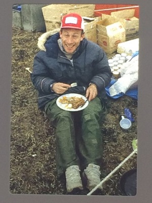
Figure 1: Scott Dallimore (GSC) enjoying a tasty camp meal during 1986 summer field program.
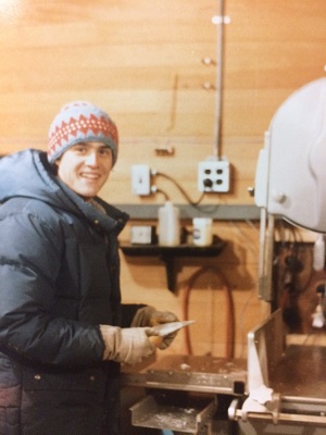
Figure 2: Steve Wolfe (GSC) working with field samples collected during 1986 summer field program.
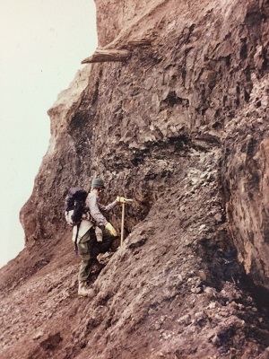
Figure 3: Steve examining the sediment exposures along Yukon Coast, summer 1986.
Thirty years later and there are still research topics to pursue! The interest during this field season is to undertake a reappraisal of all things glacial. A key objective is to consider and document the correlation of the offshore geology, which will be studied from the Araon, with the terrestrial geology present on land. Interest in this topic was stimulated by Scott and Charlie Paull, a scientist from the Monterey Bay Aquarium Research Institute (MBARI), when they visited a terrestrial exposure on the Yukon coast in 2013 and observed a sedimentary diamicton deposit with very large boulder-drop stones. This unit looked very much like the glacial deposits that we are finding offshore in our remotely operated vehicle (ROV) dives and geophysical studies. Scott, Charlie and Michelle Côté, GSC scientist, spent three days camping at Herschel Island in 2014 to sample cobbles.
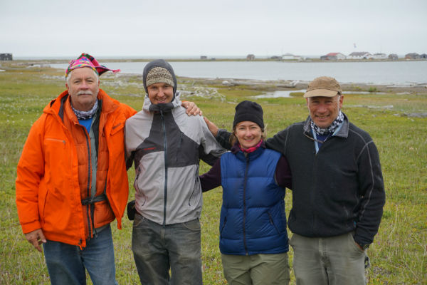
Figure 4: 2014 field party of Charlie Paull (MBARI), Malcolm Nicol (GSC), Michelle Côté (GSC) and Scott at Herschel Island. Pauline Cove and some of the historical structures are in the background.
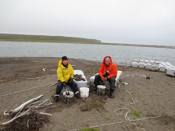
Figure 5: Michelle and Charlie preparing cobble samples at the docks at Herschel Island in August 2014.
This summer, Scott and Steve will be taking a close look at the sediments that make up Herschel Island as they appear to have formed by glacial ice thrusting of ancient marine sediments. There are very distinct ice-thrusted ridges on the island and outcrops of buried glacial ice from the Pleistocene glaciation. In addition, they will be sampling glacial sediments all along the Yukon coast to the Alaska border to document the origin of these sediments.