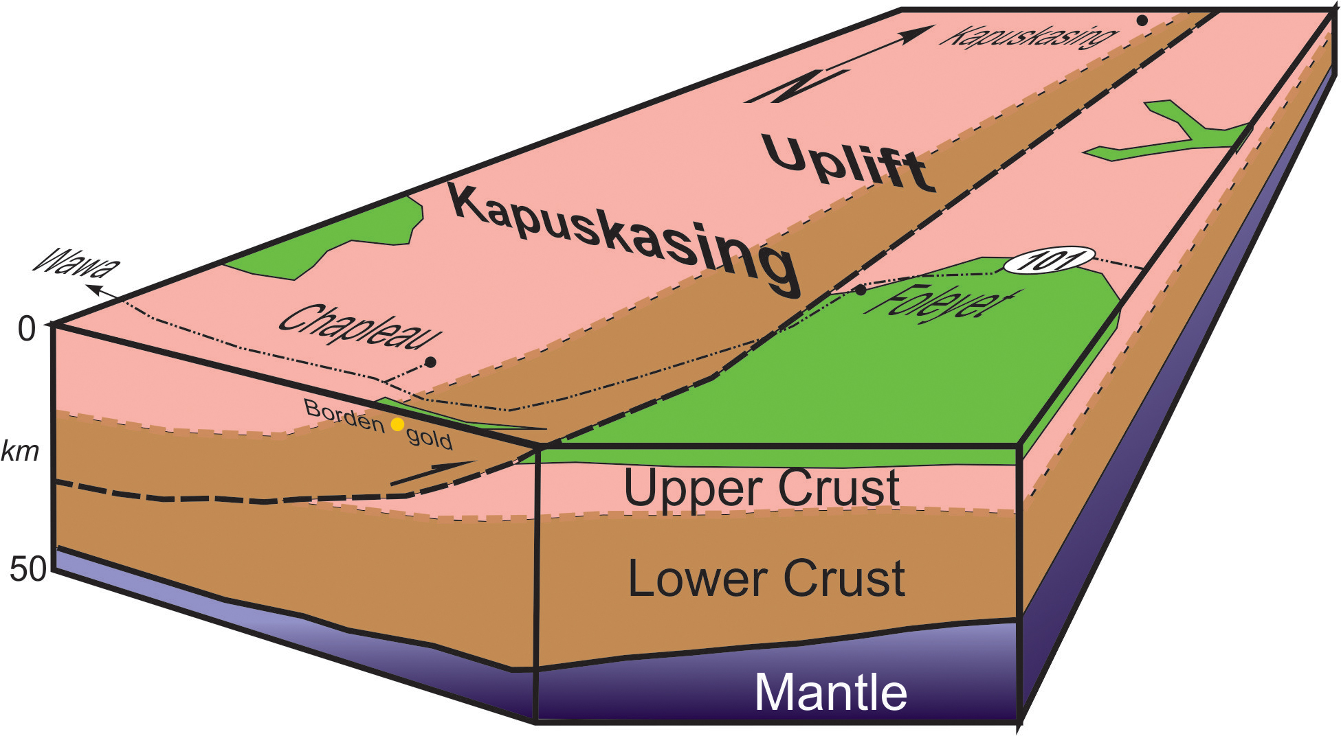
In the 1950s, major gravity and aeromagnetic anomalies crossing the Superior geological province between James Bay and Lake Superior were discovered. Regional geological mapping and research supported by the Geological Survey of Canada defined the transition from shallow greenstone belts near Wawa, Ontario, to rocks that originated at depths of 30-35 kilometres and account for these anomalies. Uplift of the deep Kapuskasing rocks was attributed to an intracontinental thrust fault, a hypothesis that provoked much interest from geoscientists in the early 1980s. This was a time when the first seismic reflection images of the deep crust were emerging, and few examples of "deep geology out in the open" were known.
In 1984, Lithoprobe, one of the world’s most successful deep investigations of Earth’s structure, was started, and the Kapuskasing Uplift was chosen as one of its initial investigations. Lithoprobe research traced features from their normal location in the deep crust to the surface, creating a natural laboratory for studying deep processes and conditions.
Hundreds of geoscientists have examined the rocks of the Kapuskasing Uplift, and the region continues to attract academic research as a unique global occurrence. The recent discovery of a gold deposit at Borden Lake is drawing industry attention to the potential for economic mineralization in rocks with a history in the deep crust.
Category: Science Advances
Decade: 1980s