
December 23, 2024
Nearly 6.1 million people live within 20 kilometres from the marine coasts of Canada. Funding from the Canadian Safety and Security Program (CSSP) is helping Canadian communities better understand risks from storm surge, sea-level rise and tsunamis to develop mitigation strategies.
With lessons learned from three communities on the Arctic, Atlantic and Pacific coasts, researchers developed a new Coastal Flood Hazard Guideline, soon to be published in the Federal Flood Mapping Guidelines series. Communities across Canada will be able to use this guideline to support evidence-based decision-making in modelling and mapping current and future coastal flood hazards.
The CSSP funding of $1.5 million over three years allowed a team to work together from across government departments and academia to develop new knowledge of coastal flood hazards. The first step in the project was to bring together a team spanning federal, provincial, municipal, Indigenous, and academic communities to co-create knowledge.
Next, researchers worked with the provinces and territories to select three communities on each coastline, each with unique challenges for coastal flooding. For instance, the Arctic community, Tuktoyaktuk, Northwest Territories, is very low-lying and is seeing increased coastal flooding with climate change.
“With the longest coastline in the world, we knew we would need to learn from communities at the community scale,” says Nicky Hastings, a coastal scientist with the Geological Survey of Canada, with Natural Resources Canada.
On the Pacific coast, the researchers worked with Semiahmoo First Nation, a small urban community spanning the Canada-United States border in the inner coastal region of British Columbia. The transboundary nation was split in half when the Canada-US border was established in 1846. During this project, researchers modelled the impacts of local and distant tsunamis, storm surge events and sea level rise that would reach Boundary Bay. The jurisdictional issues of the border and the high tide changes of up to five metres added complexity to this case study.
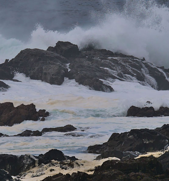
On the Atlantic coast, the research team worked with the province of New Brunswick to model a collection of small communities in northeastern New Brunswick, where the models needed to be adjusted to account for the changing impact of ice on storms.
“Ice reduces the impact of storms,” Hastings explains.
These communities are linked with bridges which can cut off transportation if they are inundated by flood waters.
Twenty-four scenarios were modelled for each of the three communities, from “nuisance flooding” that happens every two to five years to the more extreme 1-in-100-year events that, when combined with high tides and sea level rise, can intensify the flooding.
Using these case studies, researchers from the National Research Council of Canada developed hazard information, while the Natural Resouces Canada team developed flood maps and risk assessments, which outline who and what is most vulnerable to flood impacts and how they will be impacted. Risk assessments for communities can be used to apply for funding for mitigation measures, to inform land use planning, such as where and what type of buildings developers can build and emergency management plans.
About the Coastal Flood Mitigation Canada Project
The Coastal Flood Mitigation Canada project was led by Natural Resources Canada in partnership with the National Research Council of Canada, Fisheries and Oceans Canada, Ocean Networks Canada, University of Victoria, Emergency Management and Climate Readiness, and Indigenous Services Canada. Natural Resources Canada is continuing and expanding the work begun under the CSSP project, which wrapped up in 2022.
The CSSP is managed by the Department of National Defence (DND) in partnership with Public Safety Canada. Coordination of the CSSP is led by the Centre for Security Science within DND’s science and technology organization, Defence Research and Development Canada.